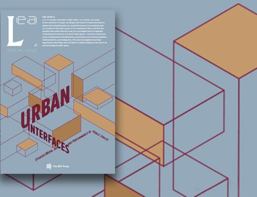
“How can architects relate to digital media?” TMC keynote at the ‘Day of the Young Architect’

December 21st, 2009

[this post also appears at The Mobile City weblog]

How can architects relate to digital media?

The Mobile City keynote at the ‘Day of the Young Architect’: outcomes and further thoughts

written by Michiel de Lange & Martijn de Waal

Introducing the main questions

What do developments in digital media have to do with architecture? And how should architects and urbanists relate to developments in new media? The Netherlands Architecture Institute (NAi) and Royal Institute of Dutch Architects (BNA) invited The Mobile City to address that question for the yearly ‘Day of the Young Architect’, on November 7th 2009 in the NAi in Rotterdam. This day was themed ‘the virtual’, and was organized as part of the overarching ‘connectivity’ cluster during the 4th International Architecture Biennale Rotterdam (IABR).

We gladly accepted this challenge, since this very issue was one of the main reasons we founded The Mobile City two years ago. After all, as the boundaries between physical and digital spaces blur, this should have profound consequences not only for new media developers but also for those professionals who traditionally deal with physical spaces. We surely did not expect this to be already obvious for most architects. But the fact that only half of the audience raised their hands when asked by moderator JaapJan Berg whether architects should deal with digital media in their profession showed there is still some way to go.

This report contains the main argument of our talk. But it also presents some additional reflections, and is an attempt to take our argument further than we did at the NAi/BNA day. We address the following questions: what position can architects, planners and urbanists take in their design profession vis-a-vis new media? Why should they bother with new media in the first place? What are the challenges they face? And what are future directions and chances for these professions?

In answering these questions, we make a strong plea for an attitude of ‘critical engagement’. This posits architects should neither ignore nor completely embrace digital media. Rather we would urge them to think of themselves as designers who primarily shape social processes, and only second as designers who shape spatial forms. Which social processes underly new commissions? What kind of activities, social interactions or exclusions should a new project encourage or discourage? How can these be shaped through spatial forms? And what roles do digital media play in this? We think architects shouldn’t just build an urban screen just because you can, or the Kunsthaus in Graz has one too. Rather they should start by asking: what kind of social processes do we want to provoke or hope to avoid? Can an urban screen indeed contribute to these processes or will it disturb them? What other disciplines do we need to invite to the table to meaningfully program an urban screen so that it goes beyond mere window dressing and indeed enhances the project?

Read more at The Mobile City weblog >>

Cartography: the old versus the new? an evening in De Balie

December 21st, 2009

[this post also appears on The Mobile City weblog]

On December 14th 2009 De Balie – an Amsterdam-based center for culture and politics – organized an evening about old and new cartographies. Participants were Ferjan Ormeling (Emeritus Professor Cartography, Faculty of Geographical Sciences, Utrecht University), Henk van Houtum (Associate Professor of Geopolitics and Political Geography, Head of the Nijmegen Centre for Border Research), Maarten Keulemans (science journalist), Jelle Reumer (director Natural Museum Rotterdam, Special Professor at Utrecht University), Lucas Keijning (NEMO science center), and me. The evening was lead by Volkskrant journalist Martijn van Calmthout. The evening was set up as a prelude to the presentation of a new world map the day after in The Hague. From the announcement:

We have been making maps for centuries, to establish territorial borders or mark safe routes. A map is a model of reality, and the terrain of a fascinating branch of science: cartography. Maps represent social and political choices, which start forming their own truths. For example the Persian Gulf is not the Persian Gulf everywhere, the world on its head or with China in the middle all of a sudden looks very different, and maps today seem less complete because of an increasing number of ‘white spots’…

flyer-hogerekaartenkunst-1.jpg

Some of the issues addressed this evening concerned the relation between model and reality, the consequences of new map-making media technologies for society and politics, and – unavoidably it seems in such popularizing science discussions – the question whether new developments are good or bad? I was invited to talk about the influence of mobile and locative media and cartographic representations.

Cartographer Ferjan Ormeling started the evening with an overview of cartography as a professional scientific discipline. He defined cartography as “the transmission of spatial information for decision-making”. In a few slides he walked through cartographic history, mainly from a western perspective as the attempt to explore and chart unknown territories, with ensuing overseas trade and later colonization in its wake. Some of the interesting topics he touched upon included the fact that cartography is always subjective and culturally determined. Dutch maps for instance often leave out ditches because they are everywhere, whereas in Belgium they are included on maps. The world maps we know today are clearly Euro-centric, placing other territories in the periphery of Europe. Maps were hugely important for an upcoming sense of nationalism (a point made by Benedict Anderson in his well-known work “Imagined Communities” 1991). Nation-states were now drawn in monochrome colors, clearly separating them from their neighbors. Further, names on maps are often surrounded by controversy. For example in the 1970s attempts were made to modernize the spelling of Dutch town and city names. This met with fierce opposition from local government, because this meant some places would lose their name-based exclusivity (Veghel sounds more chic than Veggel, ditto for Wijchen – Wijgen). Map-making therefore always involves selection, manipulation, and generalization. What is displayed? What is left out? Where are borders drawn? What is on the map and what lies outside of the map? Ormeling closed his talk by assessing the relevance of new technologies like Google Maps. Here it became interesting, since Ormeling tenaciously clung to the idea of the unique professional expertise of cartographers. While digital technologies certainly are useful, Ormeling argued, the role of cartographers remains important because they are the ones who “fill in” these satellite images, and “give meaning” to those satellite views. Sure, there are interesting attempts by amateurs to engage map-making (such as Openstreetmap). But there are lots of things professionals can and amateurs can’t do, like accurately mapping a rugged coastline.

Then Henk van Houtum and I joined the discussion. Van Houtum argued new geographic technologies like TomTom and Google Maps turn all of us into geographers. But very uncritical geographers. We unwittingly feed all kinds of information to search engines. Van Houtum worries about the loss of personal autonomy as we are surrender ourselves to various digital search and control systems. But on the more positive side, new technologies enable far more people to engage in place-making and representing spatial knowledge. The old monopoly of mapmaking by geographers under the auspice of the nation-state is crumbling, and that is a good thing.

I argued that under the influence of mobile and locative media, cartography has changed from being a predominantly geographical medium in which the representation of space and place is central, to a social medium in which online social networking acquires a cartographic element. Our mediated social relations are now being ‘rooted’ in physical places. A good example of such a locative social network is Bliin, a project by Selene Kolman, who was in the audience, and Stef Kolman. screenshot_Bliin

This has in part been a response to our perception of the internet as placeless, and broader social and spatial shifts often grouped under the name ‘globalization’. Further, New technologies offer people the opportunity to write space and place with their own experiences (e.g. by ‘geotagging’ places), rather than just reading the maps made by others (see e.g. Greenfield & Shepard about “read/write urbanism” p. 12-13). This means cartography is no longer the prerogative of professionals but indeed, as Henk van Houtum said, we have all become geographers. Already in 1946 geographer J.K. Wright proposed in front of the Association of American Geographers that the earth had been largely mapped by conventional geographical method. The time had come to map our earth all over again. Wright called upon geographers to map folk knowledge of places, and more aesthetic experiences of our environments. This would vastly expand the terrain of classic geography to include what Wright called ‘geosophical’ knowledge. Wright would probably have been thrilled to see how his plea is being realized today… A third change is that maps now consist not only of mostly spatial information but also temporal information. The historicity of place as a process is made visible by the range of micro-narratives that are attached to places through locative media. Maps become far more dynamic representations of spatial and temporal knowledge. A nice example is the project Droombeek, by Edward Mac Gillavry, who was also present this evening, and Peter Dubois.

screenshot_Droombeek01

In this project inhabitants of Roombeek, an area of the city Enschede which was destroyed in 2000 by a huge fireworks disaster, recount their memories and stories of their neighborhood. These stories are made available to others by taking a GPS-walk. A fourth change is the database structure of geographical knowledge captured in maps. We can now query items through maps. Most of these searches are about simple properties like categories of places and proximity, such as finding restaurants nearby. However while we still can’t search for sadness in New York (PDF 2,4 MB; Russell – Headmap Manifesto – p. 31), we are already awfully close.. Fifth, new cartographies alter our subjective experiences of space and place. For instance, locative media can inform a more aesthetic experience of space and mobility. Someone who is working on GPS-based cartography as a new form of landscape painting is Esther Polak, who also joined this evening – just back from a trip to Nigeria. And what about the fact that in many locative media views the ego is the center of the map? You no longer have to first find your position on the map. Rather, the environment revolves around you. Does this literally lead to a more ‘ego-centric’ worldview? Finally, maps are increasingly often used as a way to visualize and transfer increasingly complex datasets. Maps are becoming metaphors to represent information, and for thinking. An organization that has been doing this for while is Informationlab by ‘information architect’ Auke Touwslager, who also attended the evening (yes, good crowd present..). To summarize, under the influence of locative media mapping tends to shift from mostly objectifying representations to highly subjective, from general to thematic representations, and from visualizing topological rather than topographical information. I wanted to raise some more ‘political’ issues of these developments but – alas – time was running short… (I couldn’t even bring in half of the above).

It was interesting to see how the audience, and ‘old school geographer’ Ormeling, reacted to this new media story. Ormeling himself did not feel these developments had much to do with his profession as a cartographer, apart from being handy new instruments. This strikingly parallels the dominant reaction of another professional audience: architects and planners. New media technologies as instruments yes, but investigating the consequences of these technologies for the professional practice itself… no. In the audience, meanwhile, someone wondered in exasperation “this is al very nice but who actually wants to know all the time where their friends are?”. Indeed only one or two people raised their hands. Although the predominantly white middle-aged male audience perhaps might not exactly be representative of very active mobile media users, this question of course is a legitimate one. All talks about new representations of knowledge and new ‘participant audiences’ or ‘networked publics’ in spite, who are “we” (we – the people more or less professionally dealing with geo-locative media) actually representing in our talks and thoughts? The majority of people, at least during this evening, seem very skeptical about these developments. The discussion immediately turned to the pervasive influence of mobile media themselves in everyday life and all sorts of ethical discussions, rather than pausing for a moment to look at media developments and their influence on cartography. Too bad this somewhat fell of radar at the end of the evening. Luckily, columnist Jelle Reumer restored this by evoking the poetics of maps. Looking at maps above all brings up half-forgotten memories of the places one once was and where beautiful or sad things happened. Maps also stir the imagination about places one would perhaps never go. I thought Reumer’s short talk was a nice closure of the evening, which put matters in a broader perspective. Aside from their obvious differences (differences that do matter, as I’ve tried to show here), to what extend does it matter whether such imaginations occur by holding a map made of paper or by looking at a handheld screen?

Maandag 14 december, 20:00, De Balie, kenniscafé over “Hogere kaartenkunde”

December 1st, 2009

[In Dutch]

Maandag 14 december om 20:00 in De Balie is er een kenniscafé over “Hogere kaartenkunde”. Ik zit in het panel en zal het hebben over de invloed van locatieve media op cartografische representaties.

We maken al eeuwenlang kaarten, om landsgrenzen vast te leggen of veilige routes aan te geven. Een kaart is een model van de werkelijkheid, en het terrein van een fascinerende tak van wetenschap: Cartografie.

Kaarten vormen de weerslag van sociale en politieke keuzes, die vervolgens hun eigen waarheid gaan vormen. Zo is de Perzische Golf niet overal in de wereld de Perzische Golf, ziet de wereld er op z’n kop of met China als middelpunt opeens heel anders uit en lijken kaarten tegenwoordig minder compleet te worden door een toenemend aantal ‘witte vlekken’…

Martijn van Calmthout gaat in gesprek met cartograaf Ferjan Ormeling, met Henk van Houtum, hoofd van het Nijmegen Centre for Border Research, Radboud Universiteit en met Michiel de Lange, promovendus aan de faculteit van Wijsbegeerte in Rotterdam.

Zoals elk KennisCafé zijn ook columnisten Maarten Keulemans en Jelle Reumer van de partij.

Het KennisCafé is een coproductie van De Balie, De Volkskrant, KNAW en Science Center NEMO.

Meer info: http://www.debalie.nl/artikel.jsp?podiumid=politiek&articleid=327853

flyer-hogerekaartenkunst-1.jpg

article in Second Nature journal about The Mobile City project and urban gaming

November 25th, 2009

The second issue of the RMIT journal Second Nature is about “Games, Locative & Mobile Media”. I wrote a short article about urban games and their importance for the issues we address with The Mobile City.

In this article I discern five possible ‘levels’ to understand urban games: (1) the city is often used as a model to construct an architecture of computer and video games; (2) the city itself has historically been understood in multiple ways as a game or playground; (3) pervasive games take digital games out to the streets and bridge the digital-physical distinction; (4) (serious) games are used in the process of (re)building actual cities; (5) urban games are a metaphorical lens through which to look at utopian and dystopian futures of cities. For each of these ‘levels’ I raise some relevant questions.

You can read the article here >> or download a PDF of the article (1,6 MB).

There are a number of other interesting contributions. See the journal’s table of contents.

second_nature-cover_2.png

The Mobile City @IABR 2009

November 4th, 2009

The Mobile City, the project I do together with Martijn de Waal, will organize four events during the upcoming ‘connectivity’ week at the International Architectural Biennale (IABR). The overarching theme of the biennale is ‘Open City: designing coexistence”.

200911032331.jpg

This is what we’re doing:

  • November 5th 20:00-22:00 Keynote with Mark Shepard

    location: NAi Auditorium Rotterdam
  • November 6th 12:00-17:00 Sentient Rotterdam Workshop with Mark Shepard & The Mobile City. Participation is restricted to registered participants. Unfortunately, it is no longer possible to register.
    location: IABR Forum, NAi Rotterdam
  • November 6th 17:00-19:00 Opening of the Exhibition The Sentient City Survival Kit. The opening events includes a public presentation of the workshop results.

    location: IABR Open Podium, NAi Rotterdam. The Exhibition will last until November 12th. This event is followed by a Pecha Kucha Program at 20:20.
  • November 7th 10:00-20:00 Day of the Young Architect with keynote lecture by The Mobile City. Accessible to members of the Bond Nederlandse Architecten (Royal Institute of Dutch Architects).
    location: NAi Auditorium Rotterdam

For more information, see The Mobile City website >>.

PICNIC ‘09 report 1: augmented reality

October 9th, 2009

I posted the first PICNIC ‘09 report about augmented reality at The Mobile City weblog:

http://www.themobilecity.nl/2009/10/02/picnic-09-report-1-augmented-reality/

review: Stephen Graham – The Cybercities Reader (2004)

August 8th, 2009

TheCybercitiesReader.jpg

I’ve written a review of Stephen Graham’s “The Cybercities Reader” (2004) at The Mobile City. Go there >>

Visibility of urban electronics

July 9th, 2009

Not really in the field of ‘mobile media’ but here’s an observation Nicolas Nova-style. While being on holiday in France recently I saw these entrance ports in French warehouse chain Auchan.

2009-06-24_17-09-35001_50.jpg

I wonder why Auchan made these anti-theft ports transparant? Possibly the visibility of the technology behind this form of surveillance makes people even less inclined to steal stuff..? (“It looks serious so it will surely work well, I’d better watch out..”). Anyhow, transparency is one possible way to visualize the omnipresence of informational devices in urban spaces. Rather than faced with an opaque ‘black box’, we now get a better sense of what networked/informational machines are operational in our presence. I can just imagine these things being built to go off with a spectacular light show when someone tries to steal anything, just to increase public attention and shaming…

2009-06-24_17-08-08001_35.jpg

New post @The Mobile City blog: MoMoAms #11

June 9th, 2009

Mobile Monday #11 themed “Visions on Mobile” took place on June 1 2009 and had some great speakers: Alan More, Jamais Cascio, Andrew Grill, Joe Pine, Howard Rheingold, and Robert Rice.

As MoMo is a kind of trend-watching event, the main emphasis of this MoMo#11 was on the emerging field of augmented reality. Of course this vision has been around for a long time. Yet prototypes have mostly been very clunky head-mounted displays, or relied on some flat surface to project things on. As our mobile devices have by now arguably become the most ubiquitous technology humans ever carried with them (becoming a third skin, like our clothes are a second skin), they appear the ideal platform for all kinds of new forms of augmented reality in new and unexpected ways. This arguments of course echoes the argument made by Bell and Dourish (“Yesterday’s tomorrows”, PDF) that the vision of ubicomp has in actual practise taken shape in a different way on the mobile phone. Below some of my notes and impressions of MoMo#11.

Continue reading at The Mobile City weblog >>

Critique on ‘digital nomadism’ – DRAFT version

May 29th, 2009

Below the draft version of the last section of chapter 4 of my dissertation-in-progress about mobile media and identity. Not completely finished yet but readable..

090526_chapter4_section-nomadism-draft.pdf (PDF, 136 KB)